Guide To America’s Great Loop : Part 2
If you missed Part 1 of our Guide to America's Great Loop, please click here.
So, you've decided to tackle the amazing nautical journey that is America's Great Loop. After months of excitedly preparing your boat and yourself for your dream trip, the next step is getting familiar with each leg of this amazing journey. Before you embark, it's important to learn as much as you possibly can about the many routes you'll take and the stops you'll want to make along the way. Each portion of America's Great Loop offers fascinating sites, spectacular scenery and unique towns to discover. A great deal of adventure awaits you on America's Great Loop and you will make memories that last a lifetime. Don't forget, since this is a circumnavigation you can start your Great Loop cruise from any point, just be sure to factor in the seasons appropriately and head in the recommended counter-clockwise direction following river currents.
The Atlantic Intracoastal Waterway
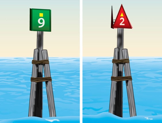
From Florida's St. Lucie Inlet to Norfolk, VA, this leg of your journey will be 978 miles. Another 279 miles to the mouth of the Hudson River from Norfolk brings your total amount of statute miles on the Atlantic Intracoastal Waterway to 1,266. All along the mostly shallow ICW you'll notice plenty of day markers and signs that clearly designate the channel, setting the stage for an incredible and well-protected passage most of the way. Heading north when cruising the Loop in a counter-clockwise direction, just remember - keep the red markers on your left or Port. Keep the green ones on your right or starboard. An easy way to remember this is to remember both the Atlantic and Gulf ICWs will take you south all the way to Texas. When cruising the ICW remember - "Red right = Return to Texas".
Rest assured, you'll never be alone on this waterway. You will find yourself running into commercial traffic on the ICW as you'll have to share with cruise ships, navy ships, tugs, barges and all kinds of commercial fishermen. You are guaranteed to witness some unforgettable sights as your cruise the ICW from gorgeous waterfront homes to unspoiled natural beauty. Just when you start to get bored, you'll come across another gem that makes the ICW voyage more than worthwhile. If you are a safe boater, like any Great Looper should be, then you will be hard pressed to find yourself in any trouble on the Atlantic ICW. Some recommended stops to make are Hurricane Patty's in St. Augustine, FL, Wacca Wacha Marina in South Carolina, the City Docks in Washington, NC and Elizabeth City, NC.
Click here for additional tips on cruising the Atlantic ICW.
The Hudson River
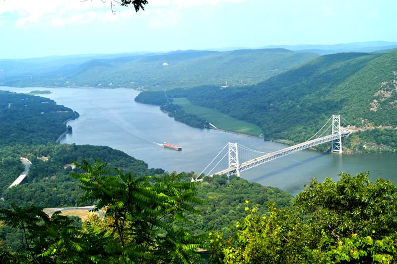
This second leg of your voyage is a spectacular 134 miles on the Hudson River which presents you with a treasure trove of some of the most beloved sites in America. You'll pass by the Statue of Liberty, the Rockefeller's and Vanderbilt's estates, Governors Island and many historic lighthouses. Not to mention you have an incredible view as you cruise by the iconic New York City skyline. Within the 134 mile stretch on the Hudson you'll encounter over 50 different marinas so there is certainly no shortage of places to tie up and disembark to see the sites. Make sure to take the time to stop along the Hudson River leg of the Great Loop to take day trips into New York City. Not your typical river, the Hudson is actually a tidal estuary where the ocean's saltwater combines with freshwater from norther tributaries. Because the Hudson River ebbs and flows with the ocean tide, it is a very diverse ecosystem supporting a large amount of various marine life species.
Click here to find out more about the Hudson River route.
The Erie Canal
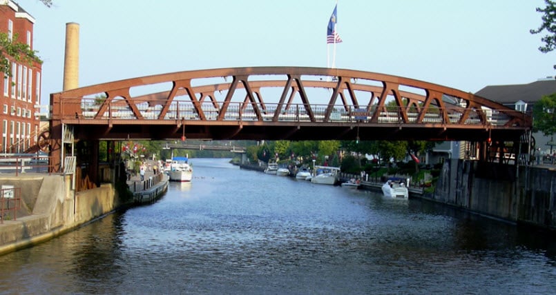
The Historic Erie Canal, which opens May 1st to September 1st, makes up the third leg of the Great Loop journey and totals 338 miles. Completed in 1825 The Erie Canal connects the waters of Lake Erie in the west to the Hudson River in the east. At the time that it was built the waterway was considered an engineering marvel and some called it the Eighth Wonder of the World. There are 57 locks on the Erie Canal that will raise your boat a combined 565 feet above sea level. Locks and lift bridges are operated from 7am to 10 pm daily. All recreational vessels using this waterway must purchase either a seasonal pass or ten-day pass. Seasonal passes range from $25 - $100 while ten-day passes range from $12.50 - $50.00, depending on vessel size. On the canal you'll have access to quite a few towns offering all the services a traveler may need. The Erie Canal has an average depth of about 9 feet and a vertical clearance of 21 feet between Waterford and Three Rivers (Oswego Canal junction), and 15.5 feet between the Tonawanda and Niagara River. This portion of the journey takes 6-7 days at a leisurely pace of 5 mph that proves to be very peaceful and thought-provoking.
Click here for a full list of bridge clearances.
The Great Lakes
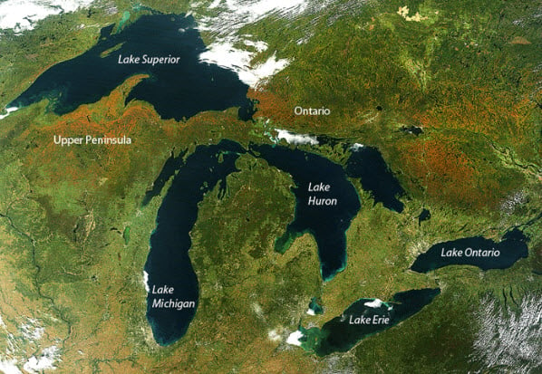
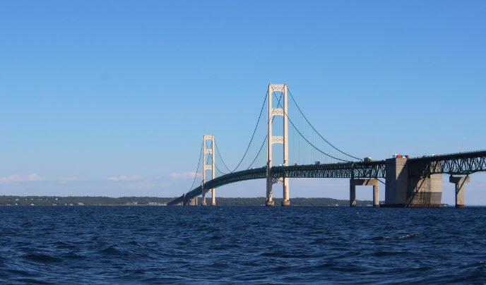
The easy and fun Great Lakes leg of the journey will clock in at 892 miles taking you about 18 days. If you are cruising through the Erie Canal, Lake Erie will be the first Great Lake that you cross. The average depth of this lake is 62 feet, with a 24 foot average depth in the western basin. Lake Erie is 241 miles long. If you take the US side trip around you can stop in places like Dunkirk, Erie, Cleveland, Sandusky and Toledo. After Lake Erie you will cruise through Lake St. Claire entering Lake Huron. At 206 miles long, Lake Huron has an average depth of 195 feet. On the North and Eastern shores of Lake Huron, the granite islands, which are typical throughout Georgian Bay, surround Canada's North Channel. Lake Huron will take you to the Straits of Mackinac where you'll be able to stop over at Mackinac Island, a favorite destination. Here you can take horse drawn carriage rides, enjoy diverse cuisine and explore a number of boutique shops and historic sites. You'll boat right under The Mackinac Bridge, one of the longest suspension bridges in the world that connects the upper and lower peninsulas of Michigan spanning 5 miles over the Straits of Mackinac where Lake Michigan meets Lake Huron. Once you arrive at this point you will be closer to the North Pole than you are the Equator.
From the Straits of Mackinac you'll reach Lake Michigan. Traveling south from Milwaukee to Chicago, the western shore is lined with big city skylines. As you approach Chicago, you'll find a variety of different marina's to dock at. Tie up at Belmont Harbor for easy access to restaurants and the Lincoln Park Zoo. Burnham Harbor is closest to the museums and aquarium. DuSable Harbor is closest to the Loop, shopping, the city's landmark Navy Pier and the entrance to the Chicago River lock. The Magnificent Mile district 13 block stretch- if you can clear 17' overhead, you will boat right thru downtown Chicago. The ride through the city on the Chicago River is nothing short of spectacular. Time your passage to reach the Amtrak RR bridge just west of the Loop after 10 AM, as it doesn't open during rush hour. From the 17' fixed bridge there is no good place to stop to re-step your mast etc. until tied up at (free) Bicentennial Park wall in Joliet. There are two ways to reach Georgian Bay and Georgian Bay's North Channel when cruising the Great Loop. One is by taking the Trent-Severn Waterway from the Murray Canal on Lake Ontario to Port Severn on Georgian Bay. The other way is to enter from Lake Huron. This area is truly a boaters dream offering unbeatable cruising with lots to do and see on and off your vessel. When it comes to natural beauty, nothing compares to Georgian Bay where you'll find pinetree landscapes, colorful rock, granite boulders scoured clean by glaciers, snug anchorages and amazing sunsets. Either way you go, from Canada on the Trent-Severn waterway, or state-side from Lake Huron, you should make time to cruise as much of the Georgian Bay as you can.
Find out more about the Great Lakes portion of your trip here.
The Illinois River
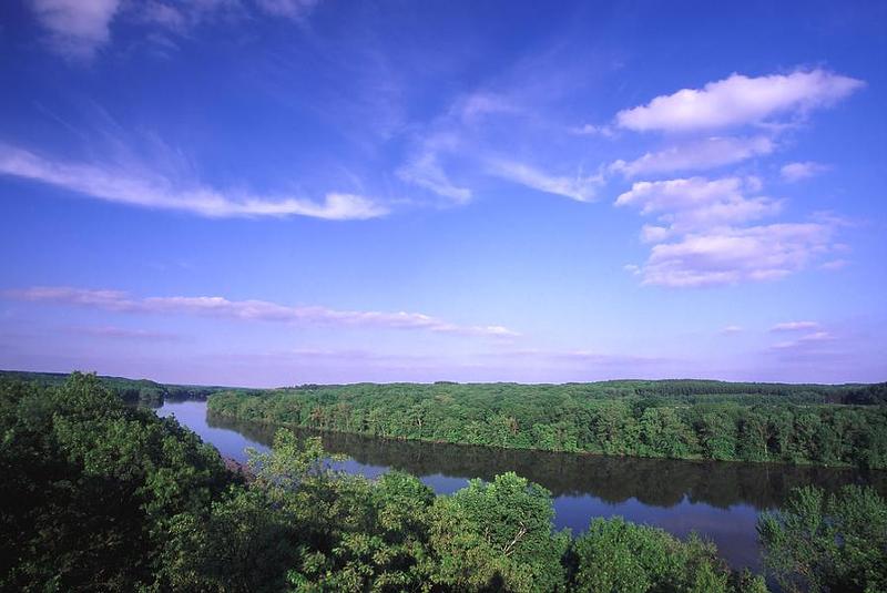
This leg of your journey will be 327 miles, and extends from Chicago to Grafton, IL at the convergence of the Mississippi River. The most scenic route takes you from Lake Michigan, through the Chicago River Lock, and right through downtown Chicago. In order to take this route however, your vessel must clear a 17' fixed over-head bridge. If you can not clear 17', you will need to continue 11 miles south on Lake Michigan to the Cal-Sag route. Both these routes merge about 3 miles upriver from that 19'1" bridge you must go under. Just past that 19' bridge, you will soon approach a hard to miss danger sign. This sign warns that you are about to enter the U.S. Coast Guard's Electric Asian Carp Barrier Field at Mile Marker 298. Designed to prevent invasive fish from entering the Great Lakes, the barriers are formed of electrodes that are secured to the bottom of the canal. A DC pulse is emitted through the electrodes creating an electric field in the water. Fish attempting to penetrate the field are exposed to electric shock, preventing them from swimming through the electrified area. When cruising through this fish barrier, the USCG mandates that everyone on your vessel must wear a Type 1 PFD. The Asian Carp in this area are easily frightened by boats and personal watercraft and because of that are notorious for catapulting themselves out of the water. Numerous boaters have reported injuries by the leaping Asian Carp. Surprisingly, some of these injuries which include broken arms and noses, have happened to boaters on live a-board size vessels.
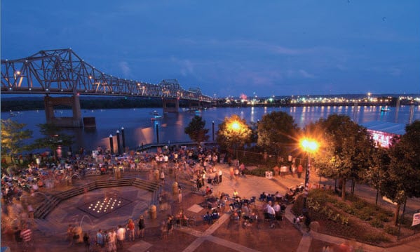
A fantastic, little known marina to stop at is the Peoria Transient Marina. A machine on the dock accepts dollar bills, and allows you to enter the amount of time you will spend. It then prints a receipt showing your departure time. The price is only a $1.00 an hour regardless the size of your boat. The town of Peoria has one of the best River Fronts on the Great Loop so get off of your boat and enjoy it. There are great Riverfront Restaurants with exceptional food and entertainment. Additionally, one block from the dock is the Peoria Riverfront Museum and theater.
Click here for a detailed list of marinas and fuels stops along the way on the Illinois River.
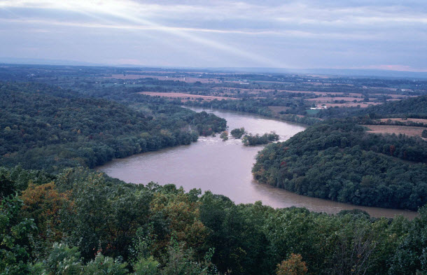
The Upper Mississippi River
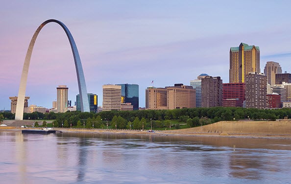
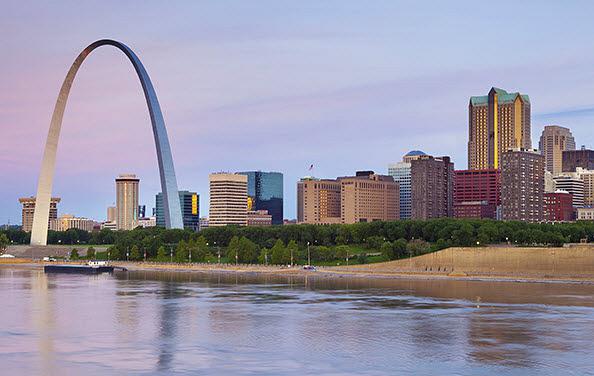
At this point in your Great Loop trip, the Illinois River flows into the Mississippi River at Grafton. You will need to fill all your tanks (fuel & water) at Grafton. From Grafton, you will take the Upper Mississippi to the Ohio River and on to the Tennessee or Cumberland rivers, to reach Kentucky Lake and make your way to the Tennessee-Tombigbee route to Mobile Bay. The fuel range required for this leg of your journey is 250 miles. You will have to make it from Hoppies Marina to either the Kentucky Dam Marina (mile 22) or Green Turtle Bay Marina (mile 25) on the Tennessee river. As you make your way on the "Great River Road" the next big city after Grafton is St. Louis, Missouri where you will pass by the famed Gateway Arch. Despite being such a notable city, there are no marinas or good anchorage options in the St Louis area. You will enter the Chain of Rocks canal at Mile marker 194.1. Do not continue down the river. The canal takes you safely past the hazardous chain of rocks reach of the Mississippi River. It ends at Mile marker 184, experience the hardest and fastest current of your entire voyage. In fact, you will race past the St Louis Arch. It is 184 miles from the Chain of Rocks to the Ohio River. If you average going down river at 9 mph it will take you 13 hours to reach the Ohio River. The Ohio River meets the Mississippi at Cairo where you'll have to decide to take the Lower Mississippi route or the Ten-Tom route.
For more info on the Upper Mississippi waterway, click here.
Alternate Route: The Lower Mississippi River
For navigation purposes, the Army Corps of Engineers has divided the great Mississippi River into two have at Cairo. The first is of course the Upper Mississippi and the second is the Lower Mississippi, an alternate route. This leg of your journey, if you choose to do it, is 871 miles from Cairo to the Harvey Lock and the Gulf ICW, just south of New Orleans. While the Mississippi River is among the top ten river cruises in the world, it's not for every captain of personal watercraft. Your decision to take this alternate route is a serious one with the issue being only two safe, convenient, stops for fuel and provisions. Only 2 fuel stops await you between Hoppies Marina or Kidd River Fuel (diesel only) and Seabrook Marina on the Gulf ICW as compared to 28 Marinas on the Tenn-Tom route. On this route your vessel must be able to provide you a gasoline fuel range of 449 miles or a diesel fuel range of 352 miles.
The Ohio River
If you've decided to take the more popular Tennessee-Tombigbee River route, your next waterway after the Upper Mississippi will be the Ohio River. Your Great Loop distance on the Ohio River is a shore 46 miles, but keep in mind that it will be against a strong river current. Starting at Cairo, IL this route takes you to the Tennessee and Cumberland Rivers at Paducah, KY., and into what is referred to as the "Land between the Lakes", and the "Heartland of America". Cruising through the Ohio River will present you with great opportunity to take unforgettable side-trips. Since you should be hitting this portion of the loop in autumn, you are in for some picture-perfect fall foliage lining the river banks.
The Cumberland River
Your Great Loop distance on the Cumberland River & Lake Barkley to the Tennessee River is an optional 33 miles. This is also your chance to take a detour to Nashville. At Cairo, you will leave the Mississippi and cruise up the Ohio River 47 miles and enter the Tennessee River at Paducah, or you can go another 12 miles and enter the Cumberland River. Both will ultimately take you to the same end destination. The Tennessee River route (mentioned in detail below) is more direct while the Cumberland route is more popular. The Barkley Canal connects these two routes just beyond Green Turtle Marina. You will find tons of scenic and safe anchorages on this river. Nashville, Tennessee is located right on the Cumberland river and is an ideal river city. They have a great riverfront with courtesy docks for those wanting to visiting the city. There are plenty of restaurants near the landing that is located right downtown. Note that the river does become narrow through Nashville so stay aware. Most Loopers take the Cumberland River route into Lake Barkley, as there is more commercial traffic on the Tennessee River, which can result in lock delays. In either case, at the entrance to the Cumberland there is a safe anchorage for vessels that can not make the distance during daylight. Your route from the Tennessee River (via Kentucky Lake) will take you to Pickwick Lake Lock and Dam, just beyond this point you will meet up with Yellow Creek. This is your cut-off to the Tennessee-Tombigbee Waterway. From the entrance to the Tenn-Tom, you are 450 miles from Mobile. Demopolis marks the official end of the Tenn-Tom. From Demopolis it is 217 miles to Mobile and Bobby's Fish Camp at mile 118.9 will be the only fuel stop between the two.
Click here to view some of the marinas and fuel stops on the Cumberland.
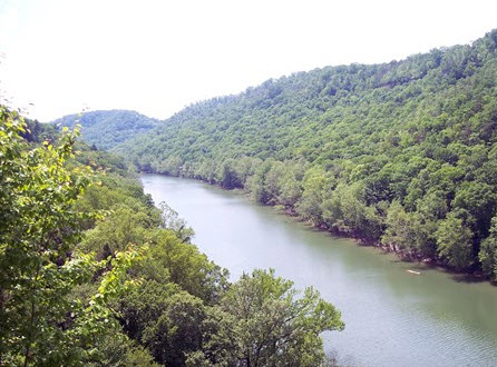
The Tennessee River and Tennessee-Tombigbee Waterway
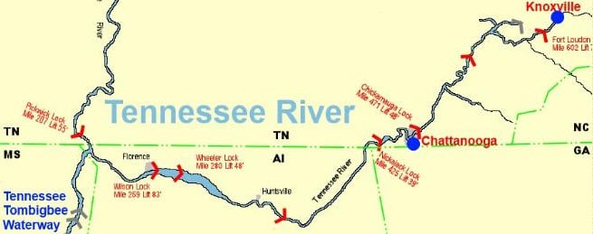
If you forgo the Lower Mississippi route, you'll find yourself on the more popular Tennessee River and Tenn-Tom voyage. Your Great Loop distance on this river is 215 miles. It is 207 miles from the Ohio River to Pickwick Landing Lock and Dam - 8 miles further is the entrance of the Tennessee-Tombigbee Waterway. Referred to in the past as the Cherokee River, the Tennessee River is one of the most popular vacation spots in America. Its rich history encompasses that of the Cherokee Indians, early colonial pioneers, Revolutionary war heroes, and Civil War battles. Today, the Tennessee River provides a magnificent variety of boat accessible concerts, festivals, museums, historic sites, landmarks, resorts and activities. The Tennessee River is also renowned for its huge smallmouth bass and blue catfish, so be sure to do some fishing through this waterway. The Tennessee River flows into the Tennessee-Tombigbee waterway, a man made canal project bigger than the Panama Canal. Once you reach it your distance to Mobile Bay is 234 miles.
For more info on the Tennesse River and Tenn-Tom loop route, click here.
The Gulf Intracoastal Waterway
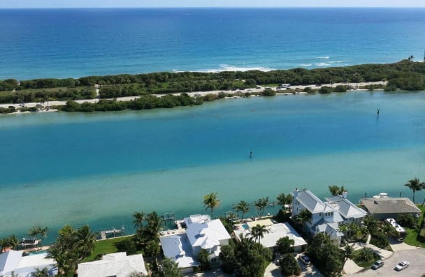
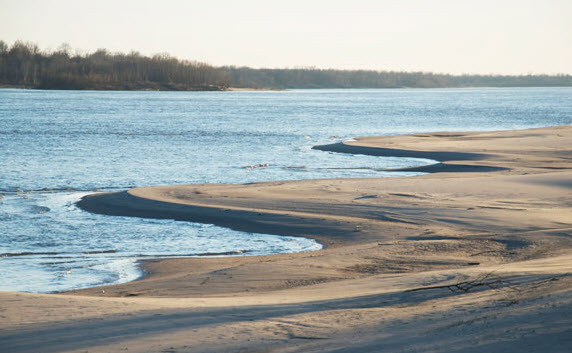
Your Great Loop route across this waterway is 218 miles from Mobile, AL to Carrabelle, FL. Not including the short trip down Mobile Bay's eastern shore to the Gulf ICW, your next 200 miles will be on a well protected interior route. The area has been described as the "Forgotten Coast" and "the road less traveled", but for you that translates into fewer tourists, where you would think more tourists would be. As you make your way on the Gulf ICW, you will cruise through some astonishingly beautiful beaches with amazing aqua-tinted crystal clear waters and white pristine sandy beaches.
Click here for more details on cruising the Gulf ICW.
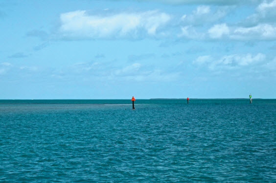
Crossing the Gulf of Mexico
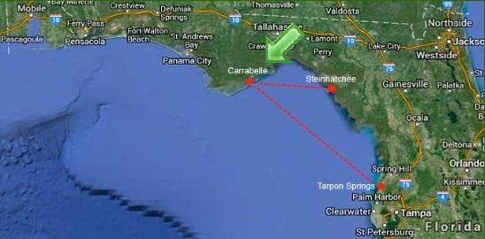
The best advice for crossing the Gulf of Mexico is to patiently wait for calm seas and the right weather forecast before making your way. Your journey across the Gulf of Mexico offers several options as you can go directly across, or you can pick and choose your way around. The voyage across the Gulf from Carrabelle, FL to Steinhatchee, FL will be between 73 to 85 miles, depending on weather conditions, your course, and how well you stay on it. Steinhatchee provides loopers with good protection from wind and waves when anchoring out, as well as easy access to shore and marinas, with several restaurants and a lot of friendly people. When you arrive in Steinhatchee, consider trying your hand at scalloping. It's a popular, family friendly activity on the West Coast of Florida and before you know it you'll have a cooler full. Scallops are easy to find and harvest in only 4-6 feet of water, all you need is a mask and snorkel. Your other option for crossing the Gulf is a 160 mile stretch to Anciote River near Tarpon Springs, FL. This happens to be the more popular yet longer route. If you head from Carrabelle to Tarpon Springs where the Florida west coast's Intracoastal Waterway enters St. Joesph Sound, you will need to depart around midnight in order to make it across for a daylight arrival.
Get more details on crossing the Gulf here.
Lake Okeechobee Waterway
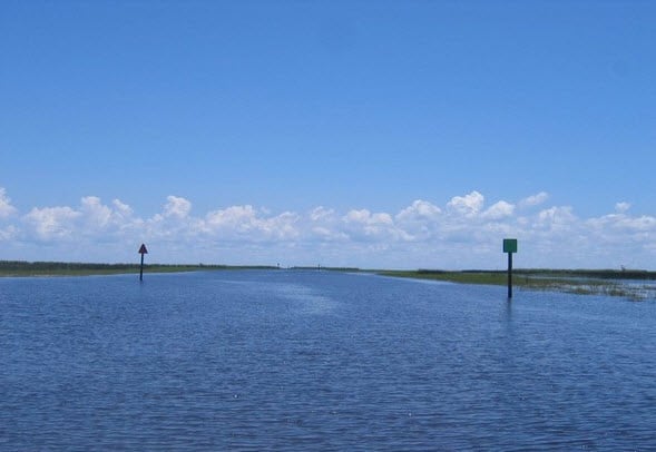
Your Great Loop route across Lake Okeechobee, which means "big water" in the Seminole Indian language, will total 154 miles. Lake Okeechobee is America's seventh largest body of freshwater and the second largest body of freshwater contained entirely within the contiguous 48 states. As you travel through this impressive waterway, a series of 5 locks will help you through this inland waterway across Florida's lower peninsula. You'll see a great deal of Florida's unique wildlife here, including alligators. The canal depth of the waterway is approx. 8 feet, and the width of the canal varies from 80 to 100 feet. Many cruisers access the waterway from the ICW through Ft. Myers, shortening their trip to the east coast of Florida and bypassing the Florida Keys.
Click here for helpful information on traveling through Lake Okeechobee.
In Conclusion
Now that you know that lies ahead of you on the Great Loop you should be feeling pretty inspired. Navigating the waters of America's Great Loop offers you the ultimate cruising adventure without ever leaving sight of shore or being too far from home. The amount of extended cruising experience you have prior to the Great Loop truly doesn't matter. Most loopers didn't have the experience until they started their journey and learned firsthand. You can accomplish this life-changing, eye-opening journey no matter what type of budget you are sticking too or what size your vessel is. All you really need is a properly equipped boat, the right preparation and most importantly a sense of adventure and curiosity. With your looper burgee proudly flying high, you will get to know yourself on a different level and discover America's history, people and geography in a way you never thought possible. So, seize the day and start your planning efforts. Once you're ready to make the trip, take it slow and soak in every experience and every state along the way.
There are many excellent resources available to you to you as you start to plan your Great Loop trip safely and efficiently.
- Click here for in-depth tips and tricks from a Great Loop expert.
- Click here to find out about America's Great Loop Cruiser's Association.
- Click here for helpful USCG navigation rules.