On the Move: The Ocean, Continental Drift and Plate Tectonics
Have you ever noticed how South America and Africa seem to fit together? If you have, you aren’t alone. Sir Francis Bacon first noticed this peculiarity in the 17th century. Today, scientists believe that 200 million years ago the Earth’s continents were joined together to form one gigantic supercontinent, called Pangaea. As the rock plates that the continents sit on moved, the supercontinent broke up and began to move apart. This “continental drift” is far from over! The Earth’s surface is constantly moving and reforming, but so slowly that you or I can’t observe it ourselves. Only by taking very small measurements over a long period of time can scientists tell something is happening.
- Facts About Pangaea, Ancient Supercontinent
- Supercontinent Cycle and Pangaea
- Continents in Collision: Pangea Ultima
Evidence Supporting Continental Drift
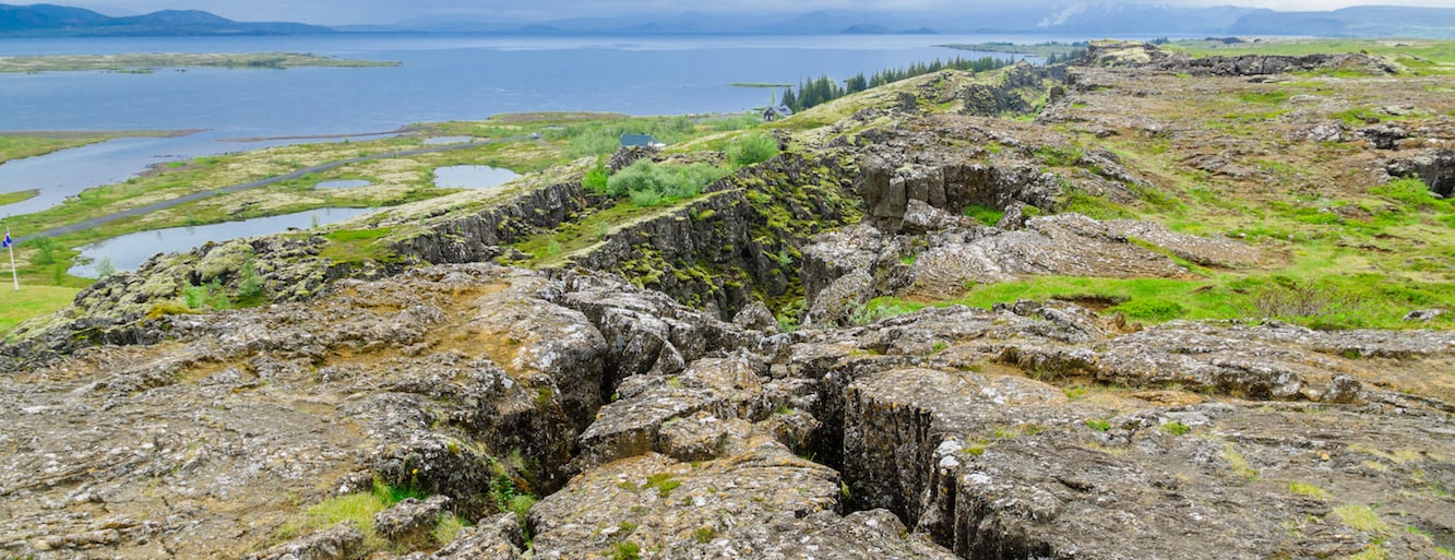
The Earth’s crust is constantly moving, both vertically and horizontally, at rates of up to several inches a year. A widely-held theory that explains these movements is called “plate tectonics.” It was developed in the mid 1960s by geophysicists. The term “plate” refers to large rigid blocks of the Earth’s surface which appear to move as a unit. These plates may include both oceans and continents. When the plates move, the continents and ocean floor above them move as well. Continential Drift occurs when the continents change position in relation to each other.
While plate tectonics is a relatively new idea, scientists have been gathering data in support of the Continental Drift theory for a very long time. In 1912, Alfred Wegener and Frank Taylor first proposed the theory that 200 million years ago the Earth had only one giant continent, from which today’s continents broke apart and drifted into their current locations. Wegener used the fit of the continents, the distribution of fossils, a similar sequence of rocks at numerous locations, ancient climates, and the apparent wandering of the Earth’s polar regions to support his idea.
- Diagram of continental drift
- Discover Continental Drift
- Continental Drift | The Emergence and Evolution of Plate Tectonics
The Shapes Match
The continents look as if they were pieces of a giant jigsaw puzzle that could fit together to make one giant super-continent. The bulge of Africa fits the shape of the coast of North America while Brazil fits along the coast of Africa beneath the bulge.
The Plants and Animals Match
Wegener noted that plant fossils of late Paleozoic age found on several different continents were quite similar. This suggests that they evolved together on a single large land mass. He was intrigued by the occurrences of plant and animal fossils found on the matching coastlines of South America and Africa, which are now widely separated by the Atlantic Ocean. He reasoned that it was physically impossible for most of these organisms to have traveled or have been transported across the vast ocean. To him, the presence of identical fossil species along the coastal parts of Africa and South America was the most compelling evidence that the two continents were once joined.
The Rocks Match
Broad belts of rocks in Africa and South America are the same type. These broad belts then match when the end of the continents are joined.
The Ice Matches
Wegener was aware that a continental ice sheet covered parts of South America, southern Africa, India, and southern Australia about 300 million years ago. Glacial striations on rocks show that glaciers moved from Africa toward the Atlantic Ocean and from the Atlantic Ocean onto South America. Such glaciation is most likely if the Atlantic Ocean were missing and the continents joined.
The Positions Don’t Match
If the continents were cold enough so that ice covered the southern continents, why is no evidence found for ice in the northern continents? Simple! The present northern continents were at the equator at 300 million years ago. The discovery of fossils of tropical plants (in the form of coal deposits) in Antarctica led to the conclusion that this frozen land previously must have been situated closer to the equator, in a more temperate climate where lush, swampy vegetation could grow.
Why Few People Believed
Wegener’s Continental Drift theory was not readily accepted by the science community of his day. It was difficult to conceive of large continents plowing through the sea floor to move to new locations. What kind of forces could be strong enough to move such large masses of solid rock over such great distances? Wegener suggested that the continents simply plowed through the ocean floor, but Harold Jeffreys, a noted English geophysicist, argued correctly that it was physically impossible for a large mass of solid rock to plow through the ocean floor without breaking up. Recent evidence from ocean floor exploration and other studies has rekindled interest in Wegener’s theory, and lead to the development of the theory of plate tectonics.
Why Should Continental Drift Matter to Me?
One of the more difficult ideas for people of all ages to comprehend is the immensity of time over which the Earth has formed and evolved. While most people have some sense that Biology has an evolving history, the physical Earth has one, too, and they are inextricably linked together.
Scientists think they have a good understanding of how the plates have moved since Pangaea broke up, but the motion is less clear in the time before Pangaea. Oceanic crust has an average age of only 55 million years (in geological terms, quite young). It is totally recycled into the Earth’s interior every 150 million years or so. On the other hand, the age of continental crust averages about 2.3 BILLION years, with the oldest known rocks dating back 3.96 billion years (old by anyone’s standard).
Some scientists studying these rocks suspect that the Earth has had several supercontinents throughout time. These supercontinents all went through a cycle similar to pangaea’s. Perhaps 200 million years in the future, people in America won’t need to cross the Pacific Ocean to reach Asia.
What can scientists predict about some of the features of the Earth existing today? Quite a lot. The Atlantic Ocean will continue to expand, while the Pacific Ocean (originaly Panthalassa Ocean) will shrink. Eventually, the Mediterranean Sea (remnant from the Tethys Sea) will disappear, connecting Africa with Europe. India will continue to push into the southern Asian continent, pushing the Himalayas higher. Meanwhile the city of Los Angles will continue its journey north to join with the city of San Francisco. This will take serveral million years to occur. Maybe in another 200 million years there will be no need for a transoceanic trip from America to Asia.
- National Geographic Society: continental drift
- Pangaea to the Present
- The Formation of Pangaea: The Making of a Supercontinent
- Geology : Plate Tectonics
- Alfred Wegener: Building a Case for Continental Drift
- Plate Tectonics – BrainPOP
- Plate Tectonics: The Rocky History of an Idea
- Continetal Drift Puzzle
- National Park Service: Plate Tectonics
- Our changing planet: Breakup of Pangea
- Geography4Kids.com: Earth Structure: Plate Tectonics
- Intro to Plate Tectonic Theory
- The Breakup of Pangea: The North America – Africa Connection
Have you ever noticed how South America and Africa seem to fit together? If you have, you aren’t alone. Sir Francis Bacon first noticed this peculiarity in the 17th century. Today, scientists believe that 200 million years ago the Earth’s continents were joined together to form one gigantic supercontinent, called Pangaea. As the rock plates that the continents sit on moved, the supercontinent broke up and began to move apart. This “continental drift” is far from over! The Earth’s surface is constantly moving and reforming, but so slowly that you or I can’t observe it ourselves. Only by taking very small measurements over a long period of time can scientists tell something is happening.
- Facts About Pangaea, Ancient Supercontinent
- Supercontinent Cycle and Pangaea
- Continents in Collision: Pangea Ultima
Evidence Supporting Continental Drift
The Earth’s crust is constantly moving, both vertically and horizontally, at rates of up to several inches a year. A widely-held theory that explains these movements is called “plate tectonics.” It was developed in the mid 1960s by geophysicists. The term “plate” refers to large rigid blocks of the Earth’s surface which appear to move as a unit. These plates may include both oceans and continents. When the plates move, the continents and ocean floor above them move as well. Continential Drift occurs when the continents change position in relation to each other.
While plate tectonics is a relatively new idea, scientists have been gathering data in support of the Continental Drift theory for a very long time. In 1912, Alfred Wegener and Frank Taylor first proposed the theory that 200 million years ago the Earth had only one giant continent, from which today’s continents broke apart and drifted into their current locations. Wegener used the fit of the continents, the distribution of fossils, a similar sequence of rocks at numerous locations, ancient climates, and the apparent wandering of the Earth’s polar regions to support his idea.
- Diagram of continental drift
- Discover Continental Drift
- Continental Drift | The Emergence and Evolution of Plate Tectonics
The Shapes Match
The continents look as if they were pieces of a giant jigsaw puzzle that could fit together to make one giant super-continent. The bulge of Africa fits the shape of the coast of North America while Brazil fits along the coast of Africa beneath the bulge.
The Plants and Animals Match
Wegener noted that plant fossils of late Paleozoic age found on several different continents were quite similar. This suggests that they evolved together on a single large land mass. He was intrigued by the occurrences of plant and animal fossils found on the matching coastlines of South America and Africa, which are now widely separated by the Atlantic Ocean. He reasoned that it was physically impossible for most of these organisms to have traveled or have been transported across the vast ocean. To him, the presence of identical fossil species along the coastal parts of Africa and South America was the most compelling evidence that the two continents were once joined.
The Rocks Match
Broad belts of rocks in Africa and South America are the same type. These broad belts then match when the end of the continents are joined.
The Ice Matches
Wegener was aware that a continental ice sheet covered parts of South America, southern Africa, India, and southern Australia about 300 million years ago. Glacial striations on rocks show that glaciers moved from Africa toward the Atlantic Ocean and from the Atlantic Ocean onto South America. Such glaciation is most likely if the Atlantic Ocean were missing and the continents joined.
The Positions Don’t Match
If the continents were cold enough so that ice covered the southern continents, why is no evidence found for ice in the northern continents? Simple! The present northern continents were at the equator at 300 million years ago. The discovery of fossils of tropical plants (in the form of coal deposits) in Antarctica led to the conclusion that this frozen land previously must have been situated closer to the equator, in a more temperate climate where lush, swampy vegetation could grow.
Why Few People Believed
Wegener’s Continental Drift theory was not readily accepted by the science community of his day. It was difficult to conceive of large continents plowing through the sea floor to move to new locations. What kind of forces could be strong enough to move such large masses of solid rock over such great distances? Wegener suggested that the continents simply plowed through the ocean floor, but Harold Jeffreys, a noted English geophysicist, argued correctly that it was physically impossible for a large mass of solid rock to plow through the ocean floor without breaking up. Recent evidence from ocean floor exploration and other studies has rekindled interest in Wegener’s theory, and lead to the development of the theory of plate tectonics.
Why Should Continental Drift Matter to Me?
One of the more difficult ideas for people of all ages to comprehend is the immensity of time over which the Earth has formed and evolved. While most people have some sense that Biology has an evolving history, the physical Earth has one, too, and they are inextricably linked together.
Scientists think they have a good understanding of how the plates have moved since Pangaea broke up, but the motion is less clear in the time before Pangaea. Oceanic crust has an average age of only 55 million years (in geological terms, quite young). It is totally recycled into the Earth’s interior every 150 million years or so. On the other hand, the age of continental crust averages about 2.3 BILLION years, with the oldest known rocks dating back 3.96 billion years (old by anyone’s standard).
Some scientists studying these rocks suspect that the Earth has had several supercontinents throughout time. These supercontinents all went through a cycle similar to pangaea’s. Perhaps 200 million years in the future, people in America won’t need to cross the Pacific Ocean to reach Asia.
What can scientists predict about some of the features of the Earth existing today? Quite a lot. The Atlantic Ocean will continue to expand, while the Pacific Ocean (originaly Panthalassa Ocean) will shrink. Eventually, the Mediterranean Sea (remnant from the Tethys Sea) will disappear, connecting Africa with Europe. India will continue to push into the southern Asian continent, pushing the Himalayas higher. Meanwhile the city of Los Angles will continue its journey north to join with the city of San Francisco. This will take serveral million years to occur. Maybe in another 200 million years there will be no need for a transoceanic trip from America to Asia.
- National Geographic Society: continental drift
- Pangaea to the Present
- The Formation of Pangaea: The Making of a Supercontinent
- Geology : Plate Tectonics
- Alfred Wegener: Building a Case for Continental Drift
- Plate Tectonics – BrainPOP
- Plate Tectonics: The Rocky History of an Idea
- Continetal Drift Puzzle
- National Park Service: Plate Tectonics
- Our changing planet: Breakup of Pangea
- Geography4Kids.com: Earth Structure: Plate Tectonics
- Intro to Plate Tectonic Theory
- The Breakup of Pangea: The North America – Africa Connection
Yacht and Boat Brands: A-J
Yacht and Boat Brands: K-S
Yacht and Boat Brands: T-Z
Get Info
Watch Price